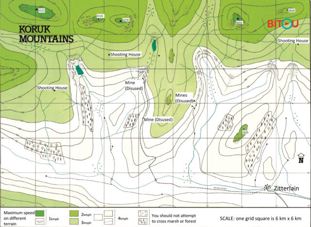
There are four ‘receptive’ locations suitable for camping and satellite communications. There are squares overlaying the map which are numbered and allow a grid reference to identify any feature on the map. You need to give grid references for the four locations.
To give a grid reference use the numbers along the bottom first and then the numbers up the side. The third and sixth number represent the number of tenths within a square. Imagine each square being made up of 100 smaller squares. Zitterlain for example is 178 026.
Note: Travel by boat or dinghy is only possible on thick blue river lines. Due to shallow water at some points where boats must be carried the overall average speed is 3 km per hour.